3D Archaeological LiDAR Scans
iPhone & iPad LiDAR field scanning of ancient sites across Peru and India
🇵🇪 Peru
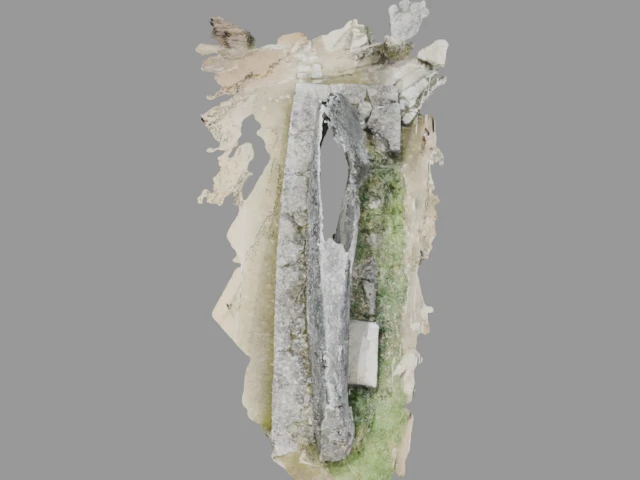
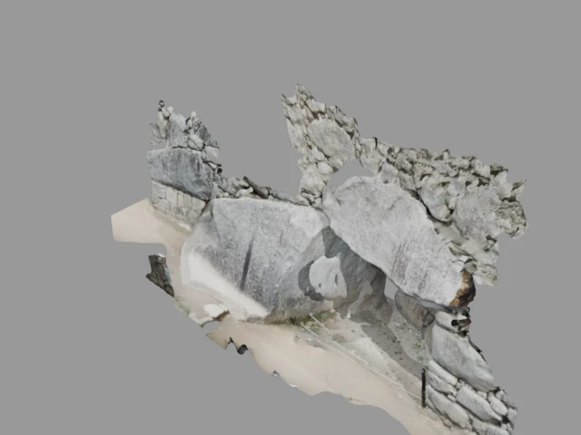
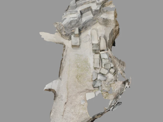
Amaru Punku (Amaru Punku (Gate of the Serpent))
Amaru Punku (Gate of the Serpent in Quechua) is a trapezoidal stone gateway near Ollantaytambo in the Sacred Valley. This ceremonial entrance features finely carved stonework typical of high-status Inca architecture. The gate served as both a control point and a symbolic threshold linked to the serpent deity, connecting agricultural terraces with the nobility quarters.
Chinchero
Chinchero sits at 3,762 meters above sea level in the Sacred Valley of the Incas. Once the royal estate of Emperor Tupac Inca Yupanqui, the site features massive polygonal stone walls, agricultural terraces, and a colonial church built atop Inca foundations.
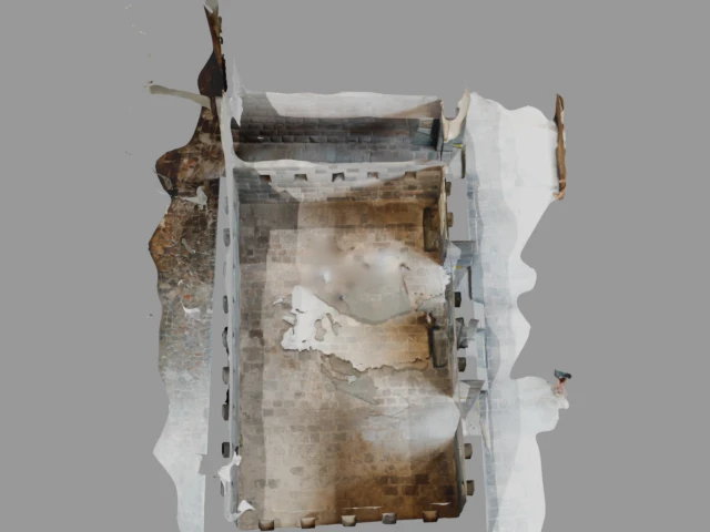
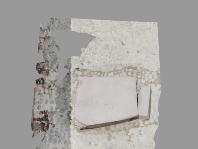
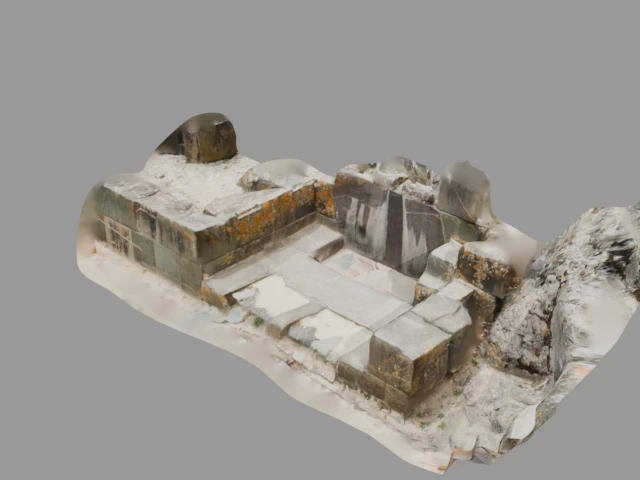
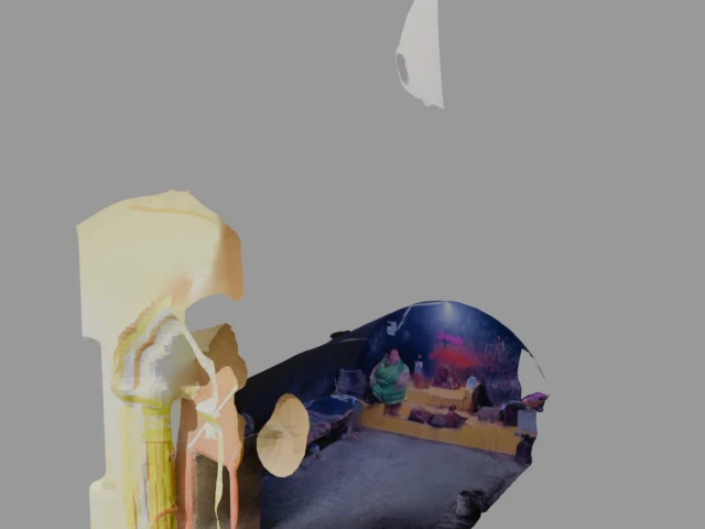
Qorikancha (Coricancha (Temple of the Sun))
Qorikancha was the most important temple in the Inca Empire, dedicated to Inti, the Sun God. Located in the heart of Cusco, its walls were once covered in sheets of gold. The Spanish built the Convent of Santo Domingo atop its foundations, but the magnificent Inca stonework remains visible.
Textured models
The following textured 3D models with full color data are available:
Cusco
Cusco, the former capital of the Inca Empire, sits at 3,400 meters in the Peruvian Andes. Founded according to legend by Manco Capac in the 11th century, the city was laid out in the shape of a puma. Its Inca walls, built with precisely fitted stones without mortar, still line many streets.
Textured models
The following textured 3D models with full color data are available:
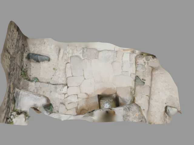
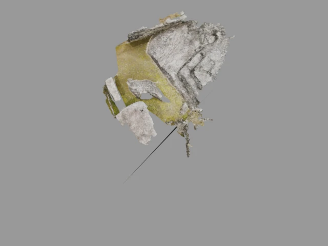
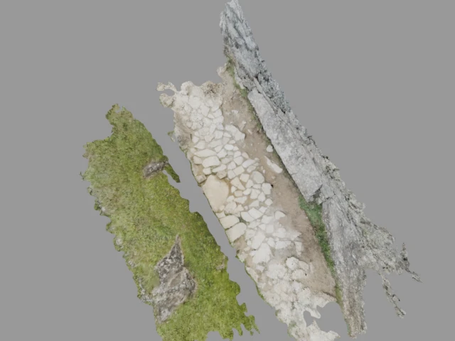
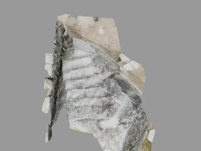
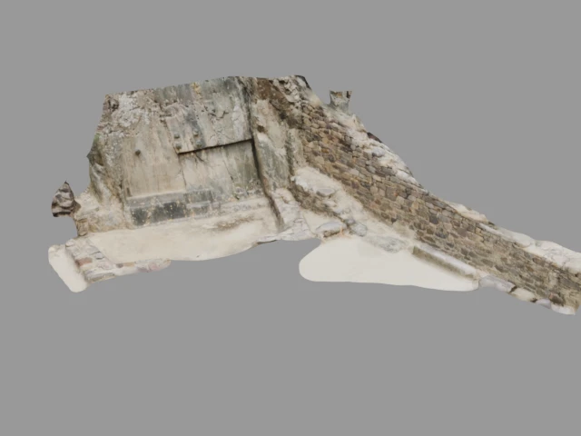
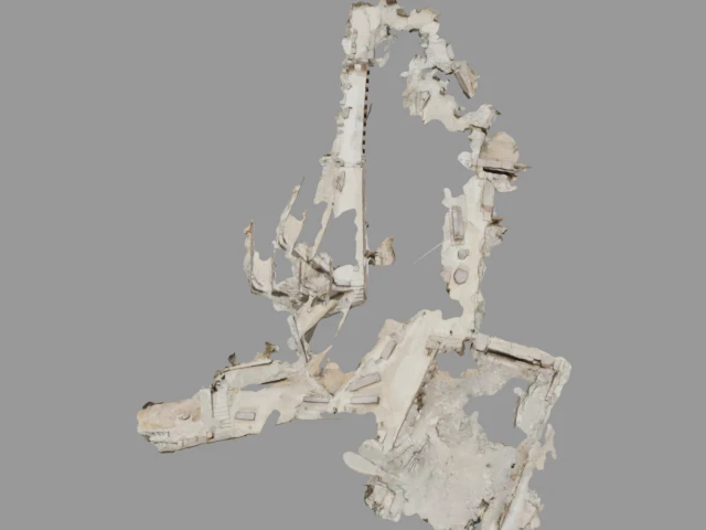
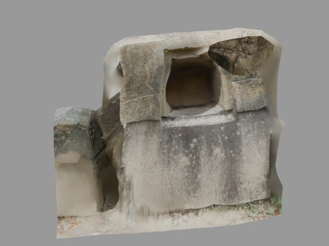
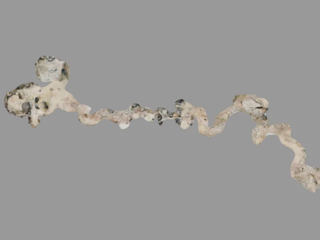
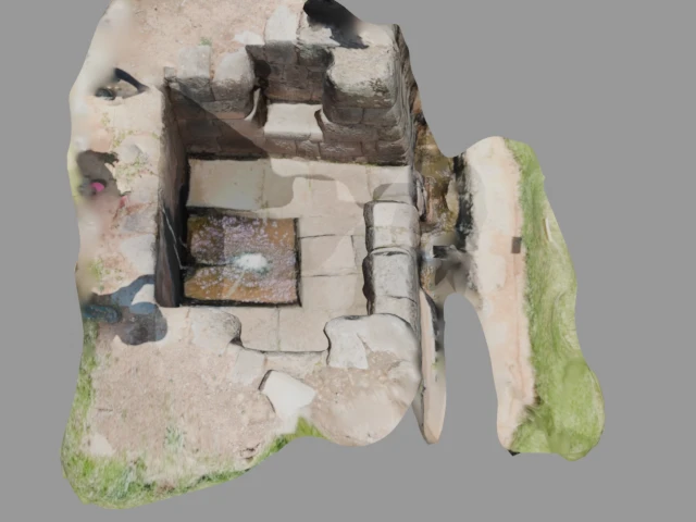
El baño de La Ñusta (Bath of the Ñusta (Princess Bath))
The Bath of the Ñusta is a finely carved ceremonial fountain near Ollantaytambo in the Sacred Valley. Featuring intricate water channels cut directly into a single rock face, the site was likely used for ritual water ceremonies. The stonework displays exceptional craftsmanship in its geometric patterns and water flow engineering.
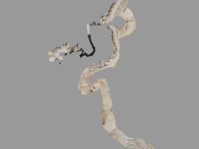
K'yuchi Muyu - Moray (Moray (Inca Agricultural Laboratory))
Moray consists of several concentric circular terraces forming deep amphitheater-like depressions in the earth. Located northwest of Cusco, these terraces create distinct microclimates at each level with temperature variations of up to 15°C. The site is believed to have served as an Inca agricultural research station for crop acclimatization.
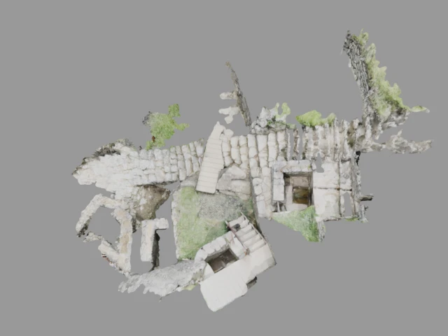
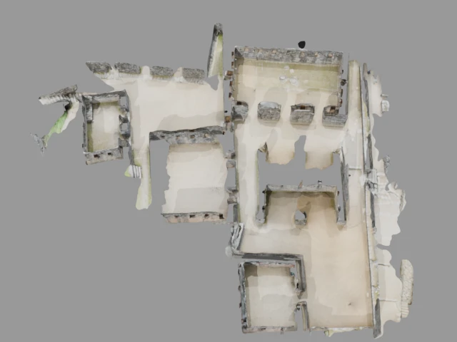
Machu Picchu
Machu Picchu, the iconic 15th-century Inca citadel perched at 2,430 meters on a mountain ridge above the Urubamba Valley. Built during the reign of Pachacuti Inca Yupanqui around 1450 CE, the site includes approximately 200 structures with remarkable dry-stone walls. Rediscovered in 1911, it is a UNESCO World Heritage Site and one of the New Seven Wonders of the World.
Observatoire astronomique (Astronomical Observatory)
The Astronomical Observatory at Machu Picchu, likely the Intihuatana stone area, was used by Inca astronomers to track the sun's movements throughout the year. The precisely carved stone pillar served as a solar clock, casting shadows that marked solstices and equinoxes essential for agricultural planning.
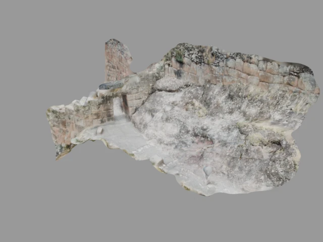
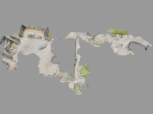
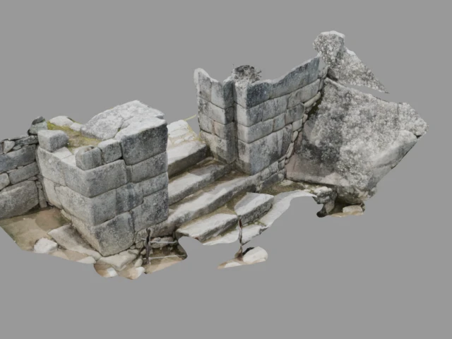
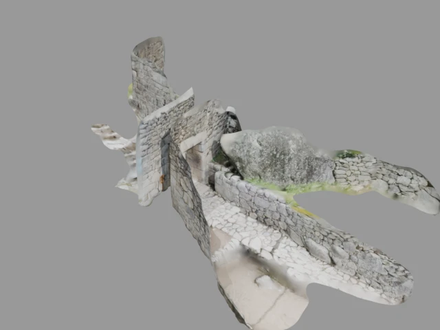
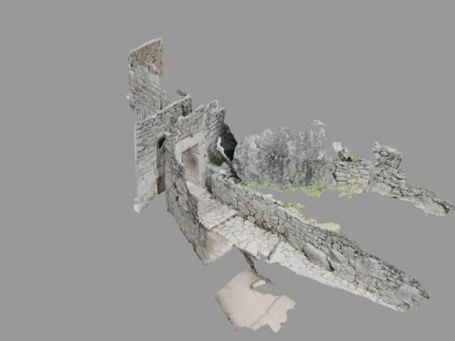
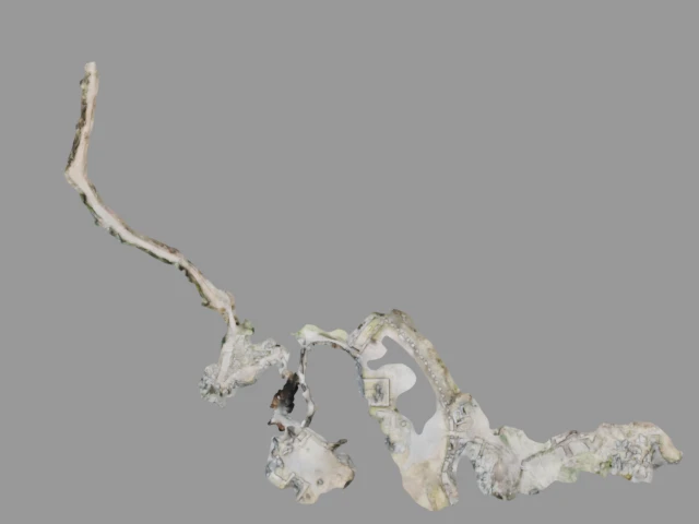
Ollantaytambo
Ollantaytambo is a massive Inca fortress and temple complex at the northern end of the Sacred Valley. Built during the reign of Pachacuti, it features monumental stone terraces, the Temple of the Sun with six enormous monoliths, and an intricate network of fountains and water channels. The town below preserves the original Inca urban grid plan.
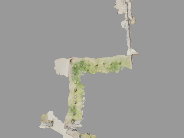
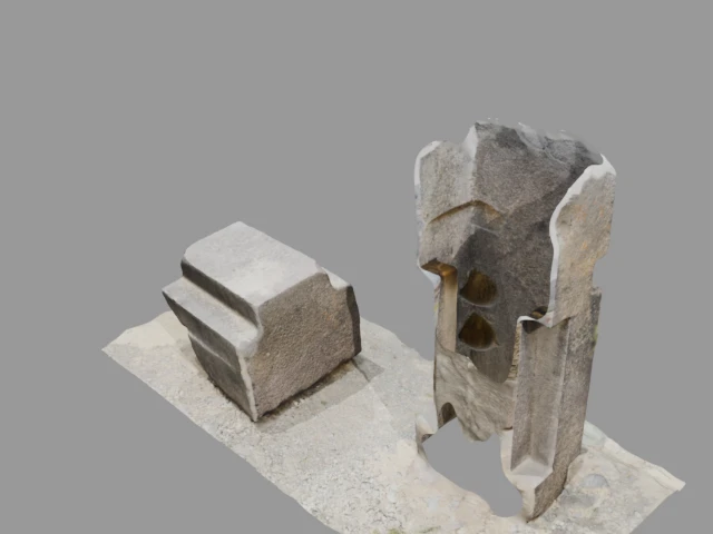
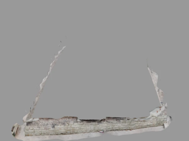
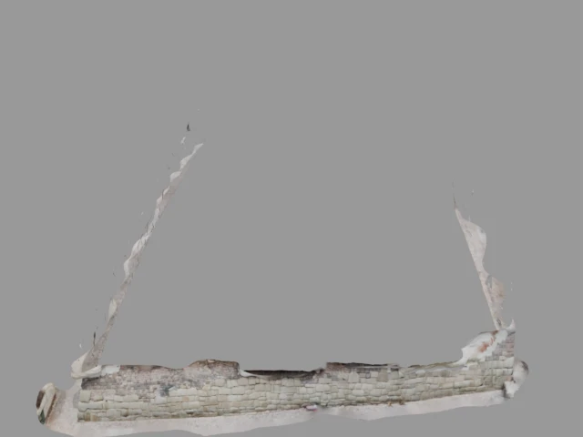
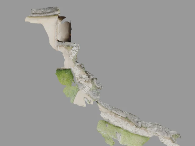
Puka Pukara (Puka Pukara (Red Fortress))
Puka Pukara (meaning 'Red Fortress' in Quechua) is a military and administrative complex located 7 km from Cusco along the road to the Antisuyo region. Its walls, terraces, staircases, and tunnels are built from red limestone, giving the site its distinctive name. The complex likely served as a checkpoint, supply depot, and lodging for travelers.

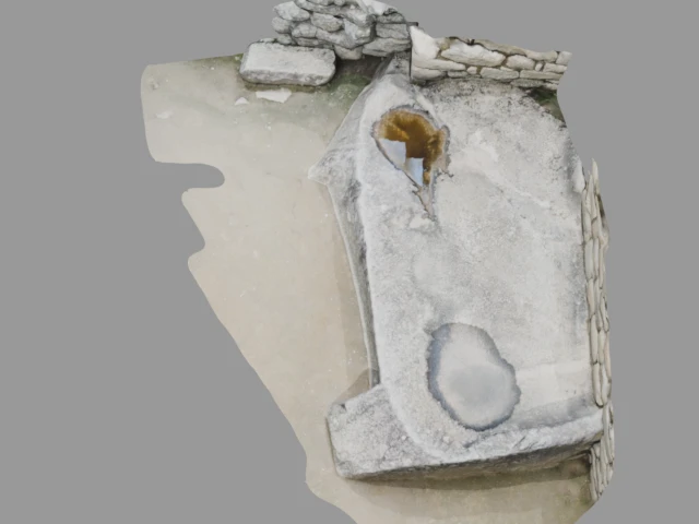
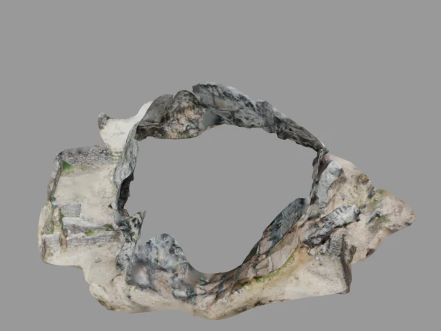
Q'enqo (Q'enqo (Zigzag))
Q'enqo (meaning 'zigzag' in Quechua) is a major archaeological site on the outskirts of Cusco. Centered around a large limestone monolith, the site features intricate carved channels, a subterranean chamber, and an amphitheater. It was likely used for ceremonial purposes, including astronomical observations and rituals related to death and mummification.
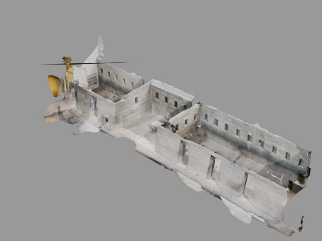
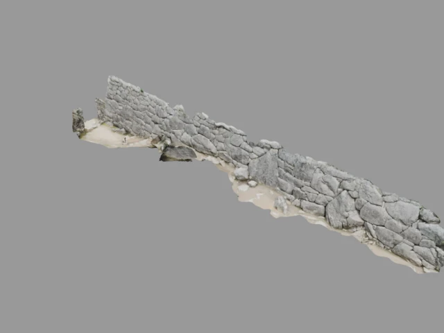
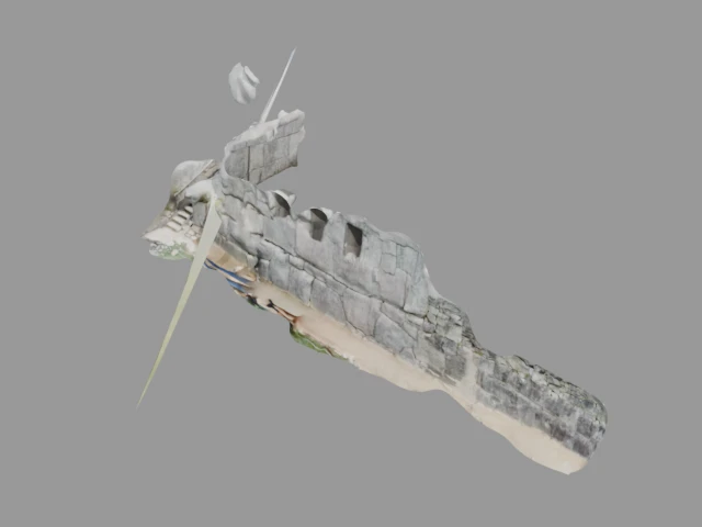
Sacsayhuaman
Sacsayhuaman is a monumental Inca citadel on a steep hill overlooking Cusco. Built with enormous limestone blocks weighing up to 200 tonnes each, its three parallel zigzag walls stretch over 600 meters. The construction, involving an estimated 20,000 workers over 60 years, represents some of the finest megalithic architecture in the Americas.
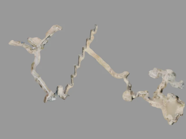
Tipon
Tipon is an Inca site located 23 km southeast of Cusco, renowned for its sophisticated hydraulic engineering. The site features a series of beautifully constructed agricultural terraces with elaborate water channels, fountains, and aqueducts that still function today. It is considered one of the finest examples of Inca water management technology.
🇮🇳 India
Grottes de Sitamarhi (Sitamarhi Caves)
The Sitamarhi caves in Bihar, India, are a group of ancient rock-cut caves associated with Hindu mythology and the Ramayana epic. According to tradition, the site is connected to Sita, the consort of Lord Rama. The caves feature carved chambers and religious inscriptions dating back several centuries.

A Passion for Ancient Civilizations
For years, I have been drawn to the monumental achievements of ancient civilizations — the precision of Inca stone masonry in Peru, the sacred geometry of Indian temples, the ingenuity of cultures that built enduring wonders with nothing but human hands and collective vision. These sites are not just remnants of the past; they are living testimony to what humanity can accomplish.
As a tech entrepreneur, I naturally turned to technology to help preserve and share these wonders. Using iPhone and iPad LiDAR sensors, I capture high-resolution 3D scans of archaeological sites during my travels. The goal is simple: create accurate digital records that anyone, anywhere can explore — whether for research, education, or pure curiosity. These scans freeze a moment in time, safeguarding details that weather, tourism, and time itself slowly erode.
Every scan on this page is released under a Creative Commons BY-NC-SA 4.0 license. Knowledge about our shared human heritage should be freely accessible. Download, study, remix — just give credit and share alike.
All 3D scans by François-Guillaume Ribreau
Licensed under Creative Commons Attribution-NonCommercial-ShareAlike 4.0 International (CC BY-NC-SA 4.0)
- BY — Credit must be given to the creator
- NC — Only noncommercial use is permitted
- SA — Adaptations must be shared under the same terms